Mapping
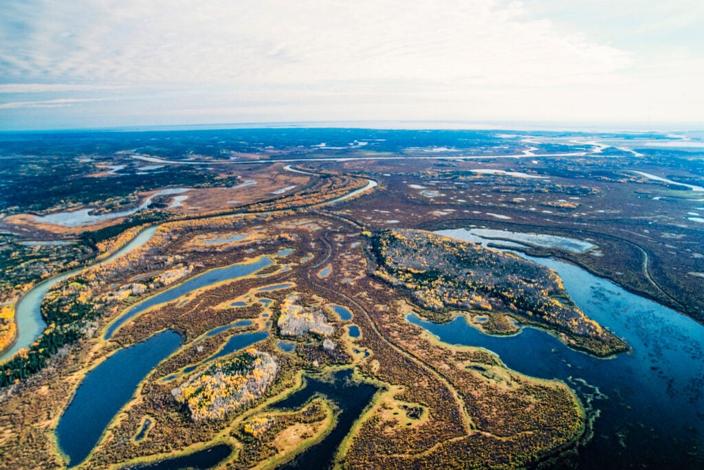
Mapping water flow in the Peace-Athabasca Delta
While most of the delta lies within the federally protected Wood Buffalo National Park, activity outside the park could threaten its future
- 734 words
- 3 minutes
Mapping
While most of the delta lies within the federally protected Wood Buffalo National Park, activity outside the park could threaten its future
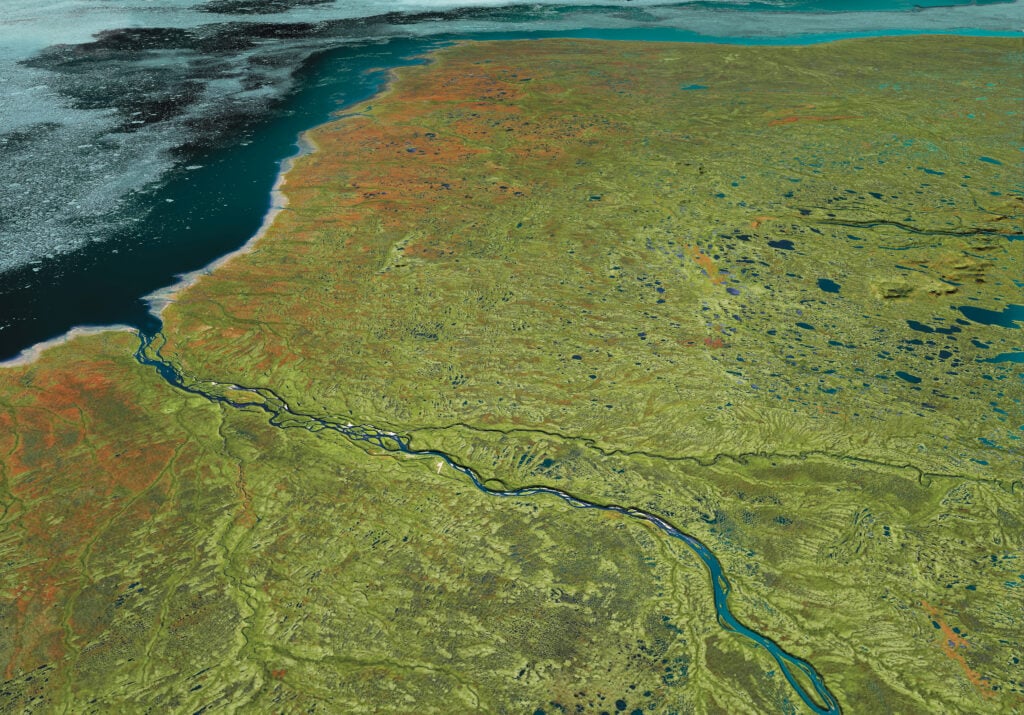
Mapping
Canadian Geographic’s cartographer explores the many facets of the Hudson Bay Lowlands, one of the world’s most significant wetlands
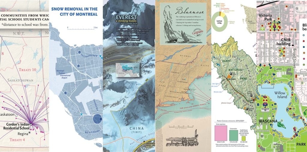
Mapping
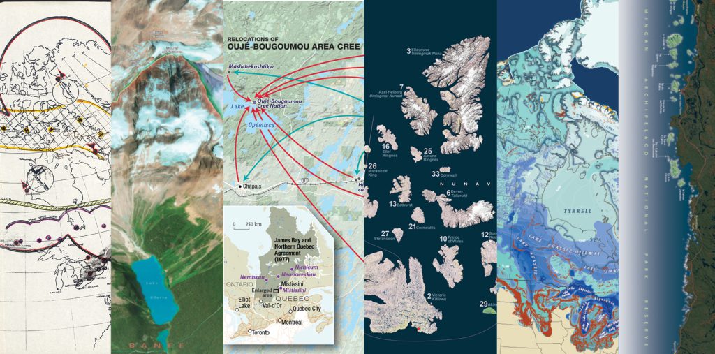
Cartographic highlights from Canadian Geographic’s 2021 issues
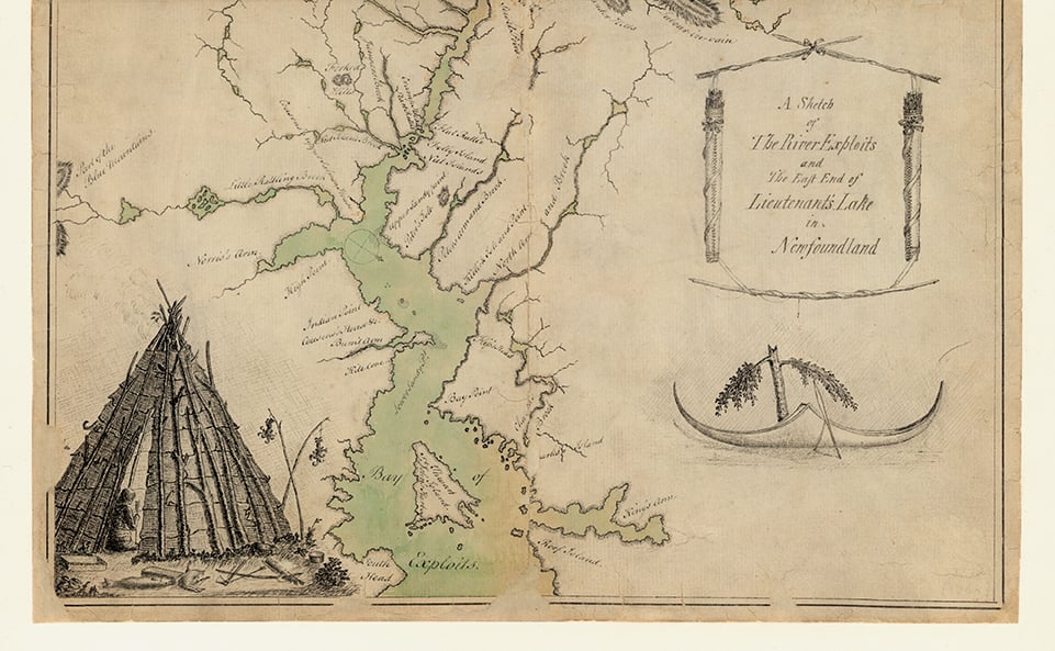
Mapping
This map, “taken on the spot in the year 1768,” tells but a tiny piece of the story of Newfoundland’s bygone Beothuk
Mapping
Cartographic highlights from Canadian Geographic’s 2020 issues
Mapping
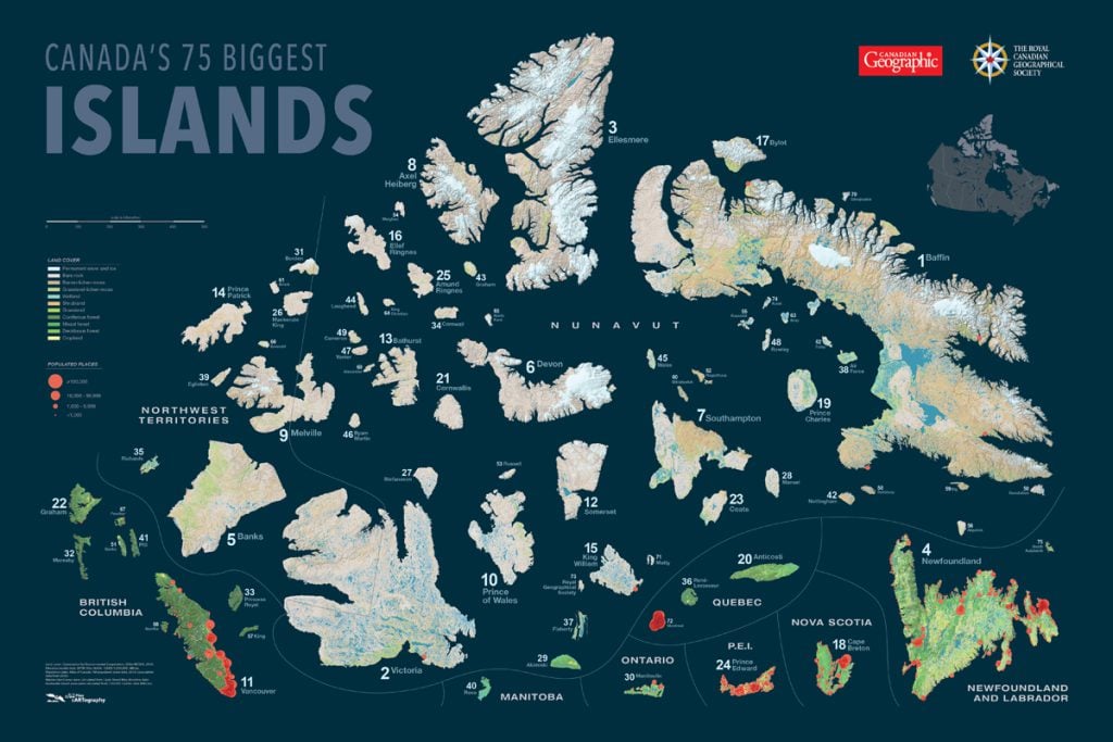
Canadian Geographic's cartographer Chris Brackley shares insights into his process in charting the country's largest islands for an exclusive wall map
Mapping
Canadian Geographic cartographer Chris Brackley continues his exploration of how the world is charting the COVID-19 pandemic, this time looking at how artistic choices inform our reactions to different maps
Mapping
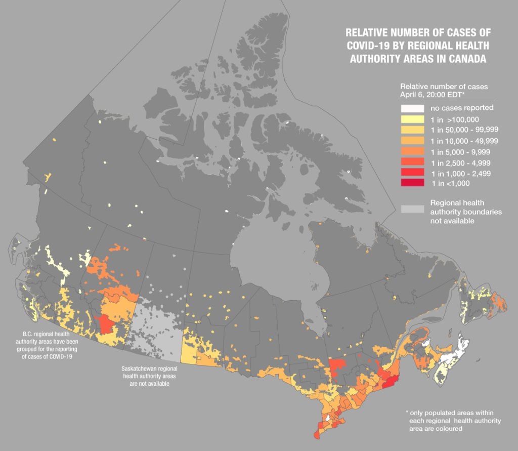
Canadian Geographic cartographer Chris Brackley continues his exploration of charting the coronavirus pandemic
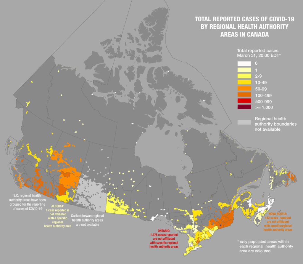
Mapping
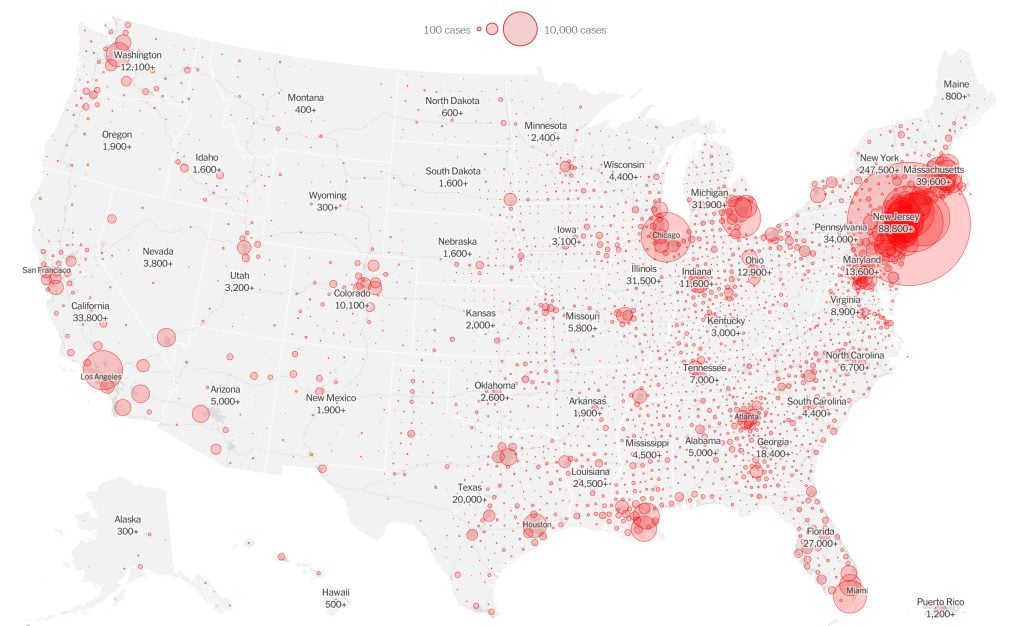
Canadian Geographic’s cartographer explores how media, scientists and citizens are charting the coronavirus pandemic
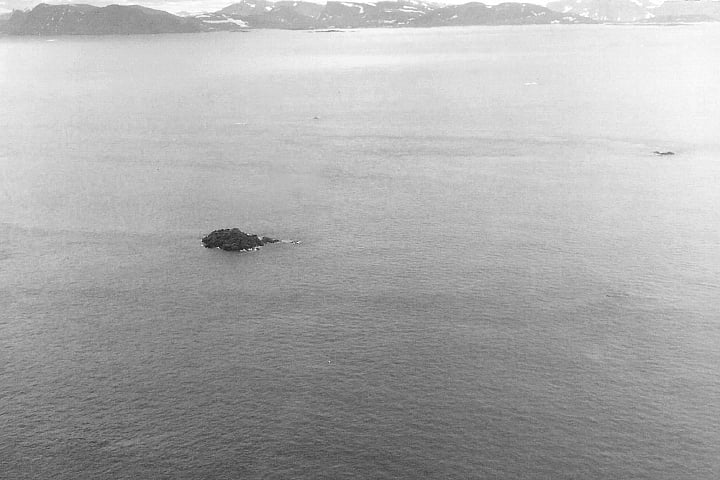
Science & Tech
A video by NASA’s Earth Observatory blog reveals the little-known history of tiny Landsat Island — and the Canadian woman who helped discover it
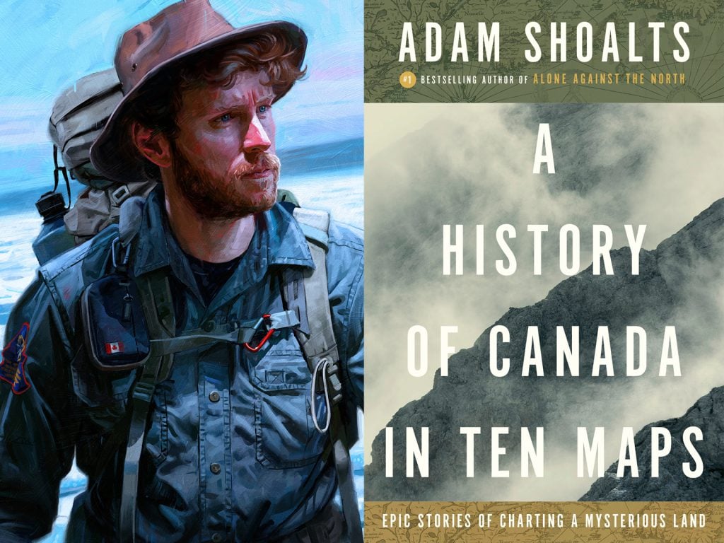
Mapping
In A History of Canada in 10 Maps: Epic Stories of Charting a Mysterious Land, Adam Shoalts delves into the fascinating stories behind the people and maps that helped shape a nation
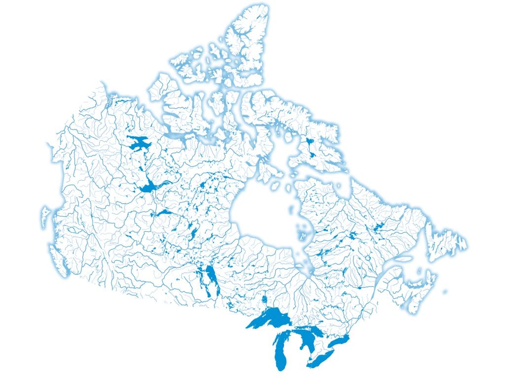
Environment
Canada is home to one-fifth of the world's fresh water. Here's what that looks like
Mapping
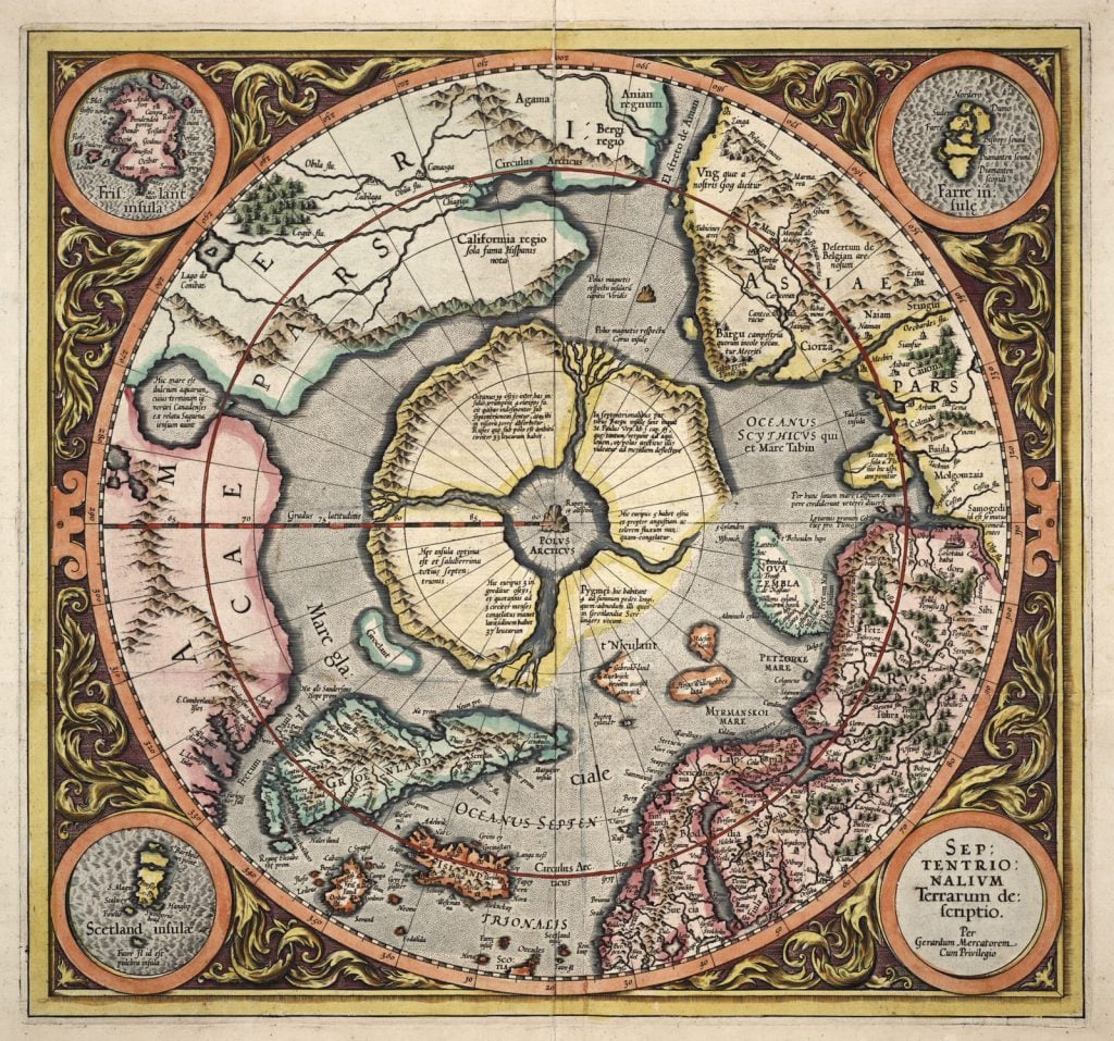
Art of Cartography exhibit at the Toronto Public Library features visually stunning maps from the 15th through the 19th centuries
Mapping
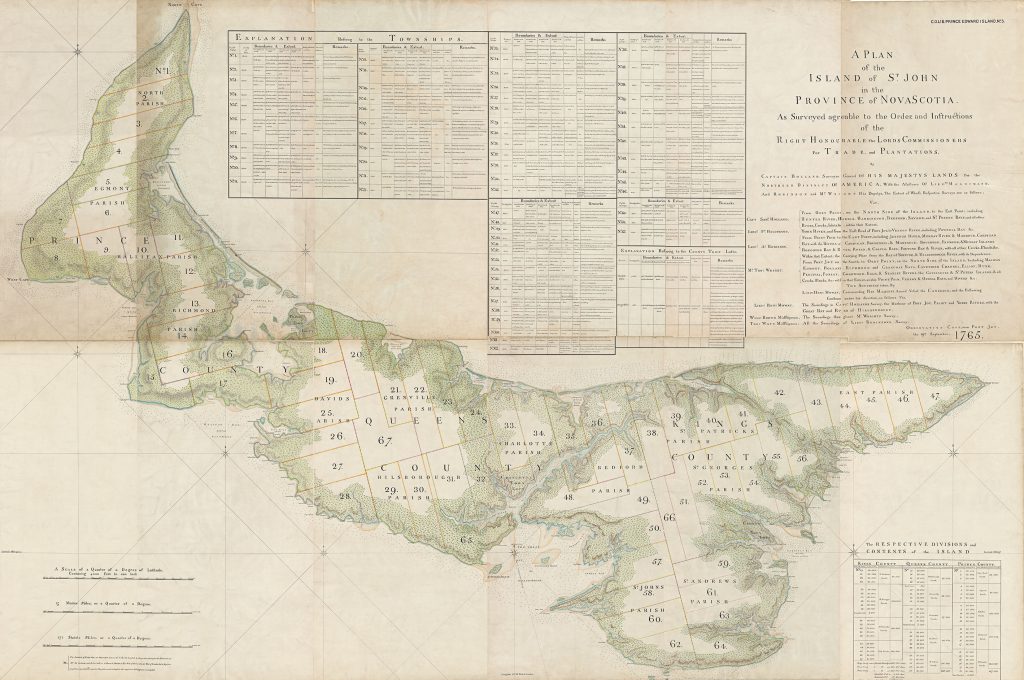
In 1764-65, surveyor Samuel Holland, on orders from the British Crown, created the first truly modern, accurate map of Prince Edward Island
Mapping
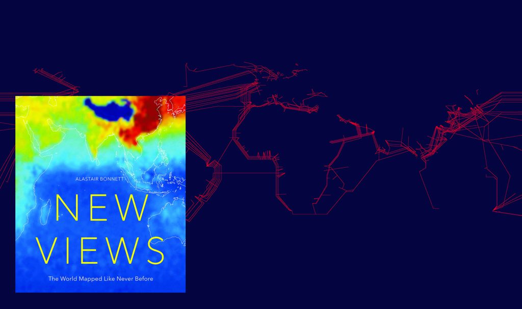
In his new book, social geographer Alastair Bonnett promises 50 maps unlike any you've ever seen. Here's a look at six of our favourites.
Mapping
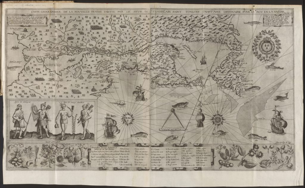
Although often unheralded in accounts of Champlain's accomplishments, Indigenous Peoples played an important role in helping the famous explorer map New France
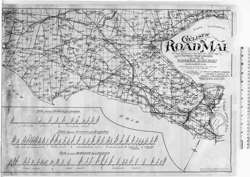
Mapping
Maps like the two pictured here were instrumental in opening up the countryside to urban North American bike owners

Mapping
Today it’s home to a yacht club, but two centuries ago Melville Island was packed with prisoners, not boats
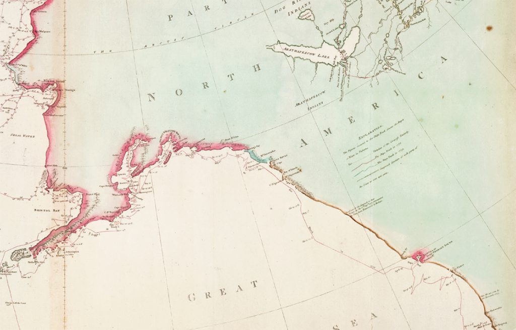
Mapping
Canada’s Pacific coast took tangible shape after a visit from one of history’s most famous navigators
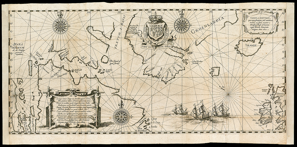
Mapping
Henry Hudson’s final voyage helped open North America’s interior, but it was a journey with disastrous consequences
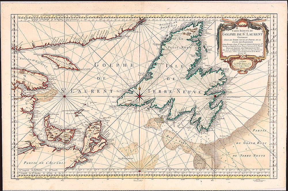
Mapping
Jacques-Nicolas Bellin’s 18th-century map reveals how the pursuit of the humble fish helped shape the nation
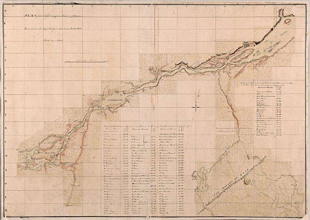
Mapping
A look at the cartographic gem commissioned 250 years ago by Quebec’s military governor